Spatial Planning at the crossroads of climate resilience and nature conservation
Land-use planning is not an alien term for the conservation community, especially in the context of species, protected areas and ecosystems management. Integration, linkage, synergy, and nexus are also buzzwords we encounter frequently. But how do we integrate climate change and biodiversity considerations into land-use planning in real terms? What needs to be done to ensure that policy and regulatory frameworks are in place from villages to the international level to sustain successful demonstration results? These are the two key questions IUCN posed at the beginning of a session organised during the UNFCCC COP 23 on 12 November in Bonn. IUCN showcased its work in Vietnam, Colombia, Tanzania and Zambia and its efforts in exploring regulatory mechanisms to ensure long-term changes. This work is supported by the International Climate Initiative (IKI) of the German Environment Ministry (BMUB).
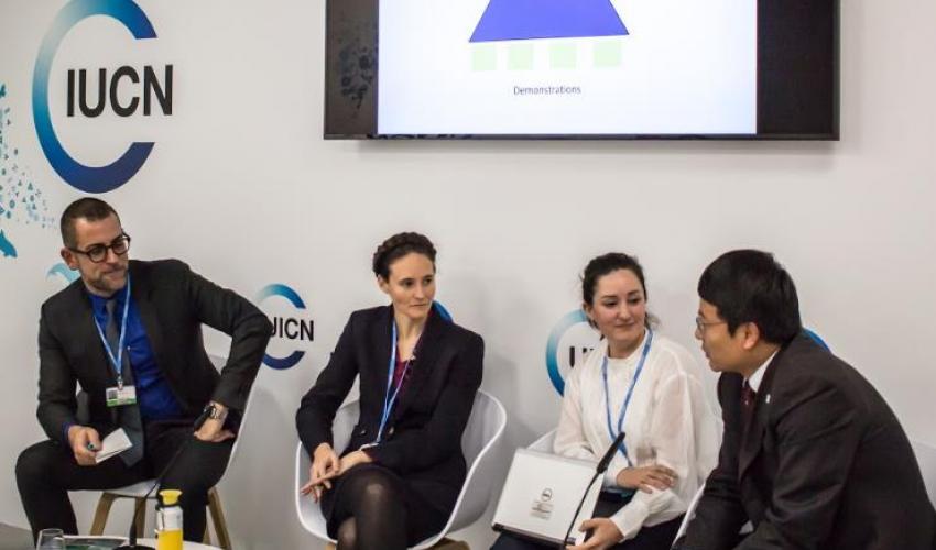
Dr. Alejandro Iza and others
Photo: IUCN ELC
In Colombia, together with the Colombian Parks authority, IUCN provides support to partners of two municipalities - San Juan Nepomuceno (Bolívar) and Santa Rosa (Cauca) on integrating biodiversity and climate resilience into municipal land-use plans. In addition, alternative resources from tourism and national budgeting for municipalities have been explored. These two sites are also included in eight case studies conducted nationwide to provide insights in integrating biodiversity and climate considerations into the land use planning process in Colombia. Learn more
In the heart of the rice producing region of Vietnam, the Mekong River Delta, IUCN focused on rice production, livelihood alternatives, wetlands and climate adaptation. An intervention at three levels (political consensus, inter-provincial and inter-sectoral planning processes) has been coupled with a strategy to restore floodplain functions and biodiversity through viable flood-retention land uses with support by local communities and farmers. Learn more
Tanzania and Zambia are two of Lake Tanganyika’s four riparians – one of the longest lakes in the world. IUCN has promoted a comprehensive assessment to recommend integration of biodiversity and climate change aspects into land use plans, development plans and management plans. Alongside site specific interventions, IUCN has improved awareness on Integrated Land Use Planning amongst stakeholders in both Tanzania and Zambia. Learn more / Video
Successful demonstrations may not necessarily lead to large-scale changes unless they are backstopped by policy and legal support. Land-use planning is very much an exercise at national or subnational level. At the international level, little work has been done to establish minimum policy and legal standards. Sixteen country assessments from a variety of jurisdictions will contribute to a global policy and legal guidance tool. This is expected to be released in 2018.
Following the brief presentation, three panellists-Lifeng Li from Wetlands International, Jennifer Kelleher from IUCN Global Protected Areas Programme and Lydia Slobodian from the Environmental Law Centre exchanged points on how to strengthen legal and policy frameworks for land use planning. Alejandro Iza, Director of the Environmental Law Centre, chairing the side event, concluded by emphasising that “as the impacts of climate change gradually increase, there is a need to provide effective tools to ensure the integrity of ecosystems and livelihoods of vulnerable communities. Land use planning should be one of these tools and we need to work in its further development and implementation, particularly in those countries most affected”.
Related content
Le Plan national de développement du Burkina Faso entend dynamiser des secteurs tels que l’…
Dans le cadre de la mise en œuvre du Projet de Facilitation d’Engagement pour la Biodiversité…
Les nouvelles CEESP: Emmanuel Mvé Mebia, membre du IUCN CEESP. Basé sur les recommandations…

S’abonner à un bulletin de l’UICN.